Geographical location
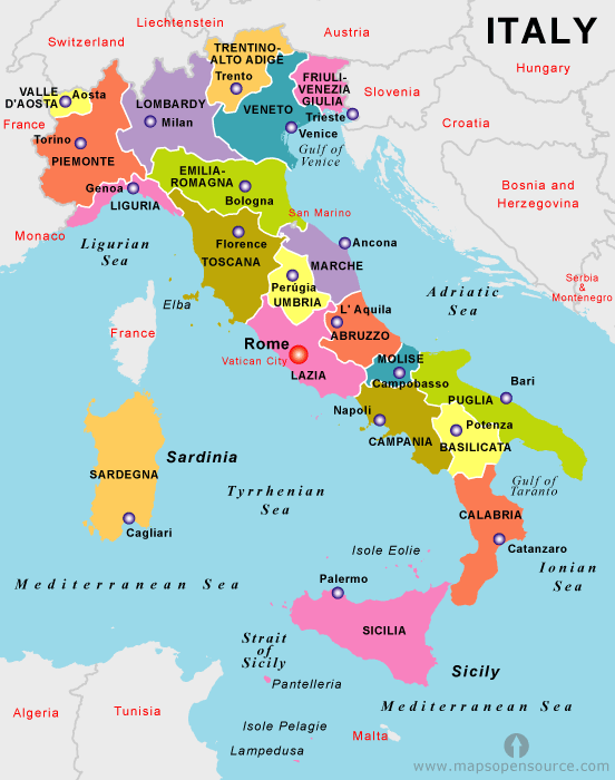
Italy covers a long boot-shaped peninsula in Western Europe as well as the islands of Sicily and Sardinia. The country has coastlines with the Adriatic andTyrrhenian Seas both of which are parts of the Mediterranean Sea. Italyshares borders in the north with France, Switzerland, Austria andSloveniaFrom snow-capped mountains in the north to year-round warmth in the south, Italy has a truly varied climate. Winter temperatures vary greatly across the country from the Alpine climate in the north to the southern Mediterranean climate of the south. It can be subzero in Milan while it’s 20°C in Palermo, Sicily. In summer the differences are much less marked. There are big differences between the coastal regions and the interior of the country, especially as you gain elevation. The mountains create many microclimates. The record low temperature recorded in Italy is -29°C. This excludes elevated areas where it can get much colder: -45°C has been recorded in the Italian Alps. The record high is 46°C in the far south of the country.
Italy is a very mountainous country with the Alps in the north and the Apennine mountain range that extends right down the peninsula and rises to over 2000m in parts. The islands of Sicily and Sardinia are mountainous too – the 3323m high Mt Etna sits on the east coast of Sicily. The plains south of the Alps are the only flat part of the country.